
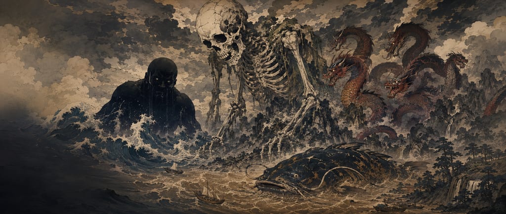
Daidarabotchi

AdPractical Japan travel guides · 2jp.cc

Basic Description

Daidarabotchi is a giant said to have carried great mountains and to have left footprints whose hollows filled with water to become lakes, ponds and marshes. He is also called Dairabotchi or Dēdarabotchi; Yanagita Kunio thought the name came from "Daitarō-bōshi," and Minakata Kumagusu said much the same. The legend is found widely from Kantō to Chūbu and is especially dense within Tokyo, where Nagasawa Toshiaki visited some thirty sites on foot.

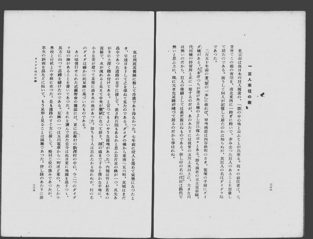
In "Daidara-bō no ashiato" ("The Footprints of Daidara-bō"), published in 1927, Yanagita wrote that "the city of Tokyo can be called one of the centers of Japan's giant legends." At Daita in Setagaya there was a hollow said to be the print of a right foot, about a hundred ken long, with a small shrine hall and a spring-fed pond at its bottom. Yanagita believed the village name Daita came from this footprint. Senzoku Pond in Ōta Ward is said to be either where the giant planted his staff or where his urine pooled. In Musashino a story says that the giant's first step became Zenpukuji Pond, his second the hollow at Hatchō and his third Inokashira Pond.

Giants shaping the land also appear in the ancient fudoki. In the entry on Ōkushi Hill in Naka District, the Hitachi fudoki says that in high antiquity there was a person of enormous size who sat on the hill and gathered clams to eat, and the shells piled up into a hill. The giant's footprint was more than forty paces long and more than twenty wide, and the hole of his urine about twenty paces across. Yanagita, however, did not think that the giant stories told in modern Hitachi were the fudoki's Ōkushi Hill story surviving unchanged for more than a thousand years.

Folklore & Legends

Yanagita Kunio's "Daidara-bō no ashiato" appeared in the April 1927 issue of Chūō kōron and was later collected in Hitotsume kozō sono ta (1934). Yanagita quotes Toda Mosui's Murasaki no hitomoto, which says that the Daita Bridge beyond Yotsuya Shinmachi on the Kōshū Kaidō, before Sasazuka, was said to have been built by "Daita-botchi," and once he had left government service and had time, he set a day to visit the site. Five or six chō southeast of the bridge, beside a road through the fields, was a hollow like the print of a right foot about a hundred ken long, pressed deep into the ground with the toes rising. Water ran down its middle like a groove, and at the heel stood a small shrine hall beside a spring-fed pond. Following articles in the journal Musashino, Yanagita went on to see two more footprints in neighboring Komazawa village.

Setagaya Ward introduces as a leading theory that the place name Daita comes from this giant's legend. A hollow west of Daita, near today's Moriyama Elementary School, was a marsh fed by rain and spring water whose shape resembled a human footprint, so villagers called it the footprint of the giant "Daitarabotchi," and a bridge over the nearby Tamagawa Aqueduct, said to have been built by the giant in one night, was called Daita Bridge. The area was already called "Daita-tamuro" in 1569.

Before the Toshima ferry in Kita Ward, too, there was "the mound of Daidō-hōshi (Daidabotchi)" recorded in Daijō Keijun's Jippōan yūreki zakki. It was said to have formed when earth stuck to his straw sandals fell off; the owner of the field, who leveled a small mound beside it, fell ill for many years, so no one would put a sickle to this mound.

About Senzoku Pond, Tanigawa Iwao wrote in Musashino in 1919 a story he heard from a farmer. The hollows at Suribachiyama in Ōokayama, Fusuma village, and at Mujinakubo in Senzoku village were where Daidarabotchi once planted his feet, and the place where he planted his staff became Senzoku Pond. When he took earth from one side with one hand and put it on the other, the place he took it from became the sea at Shinagawa and the place he put it became Mount Fuji. The History of Ōta Ward (1983), which compiled postwar folklore surveys, tells it a little differently: Daidarabotchi planted his staff around Senzoku, braced himself and urinated. The place that rose where he braced his right foot became Suribachiyama, the hollow under his left foot became Mujinakubo, the hole of his staff became Koike Pond, and where his urine pooled became Senzoku Pond. The same book tells of a clan of giants with long right arms who lived at the Kugahara shell mound; they reached into the sea every day to gather shellfish, which made their arms long, and the mound is where they threw away the shells. .

According to Ōta Ward's natural-environment survey, Senzoku Pond and Koike Pond lie in a valley floor cut by running water into the Ebara upland, a diluvial plateau a little over 30 meters above sea level, and they are surrounded by bowl-shaped bluffs. .

In Musashino City there is a story that a very big person, from no one knows where, passed through Musashino and the ground sank wherever he stepped. His first step was at Zenpukuji, where water welled up into a pond; his second, at Hatchō, sank into a hollow, and a lump of earth that fell from his foot became the Hatchō Ōtsuka mound; his third was at Inokashira, where water welled up into a pond as well. The giant is called "Heitarabotchi" or "Daida-hōshi." The Hatchō hollow has been filled in, and only the Yokogawa Electric sports ground keeps its shape.

In the Sayama Hills the giant is called Deedarabotchi. Maruyama in Musashimurayama is said to be a mountain that Daitara-hōshi carried on his back with wisteria vines; the vine broke here and he left it, so wisteria does not grow on this hill. Sayama no shiori (1939) records that the wells on the hill are the footprints he left. At a well in the hills of Akahori stands a sign headed "The Well of Daitara-hōshi," saying that a big man called Daitara-hōshi walked carrying Maruyama on his back with wisteria vines, and his footprint became the well. .

The Fujizuka mound in Fujimi-chō, Tachikawa, formed when the giant, walking along in enormous geta clogs, knocked out the earth packed between the teeth of his clogs; the Benten Pond below the bluff is where rainwater collected in the hole he left as he walked. In Yui village near Hachiōji, a hollow called Ike-no-kubo is said to be the print of one foot Deedarabotchi planted in a single stride when he tried to lift Mount Fuji onto his back, and the other footprint is said to be in Suruga Province. A small hill at Nagire in Kawaguchi village is a mountain he dropped when the rope he carried it with broke; unable to find wisteria vine to tie it, he grumbled, "From now on let no wisteria grow on this hill," and to this day it does not. .

Oyamada Tomokiyo's Matsunoya hikki records a tale from Musashi and Sagami: the great marsh on Sagami plain is the footprint of Dairabotchi bracing himself to carry Mount Fuji on his back, and there is no wisteria on that plain because he searched for wisteria vine to use as a carrying rope and found none. Far away in Ōmi, Kidan isshō tells that Daida-hōshi dug up all the earth of Yoshizumi District into one basket load, walked three and a half steps east and tipped it out; the place he dug became the lake, and the earth became Mount Fuji.

The ancient Hitachi fudoki, in its entry on Ōkushi Hill in Naka District, says that in high antiquity there was a person of enormous size who sat on the hill and gathered clams to eat, and the shells piled up into a hill. People of the time took the sense of "great decay" and called it Ōkushi Hill. The giant's footprint was more than forty paces long and more than twenty wide, and the hole of his urine about twenty paces across. This hill is the Ōgushi shell mound in Shiozaki-chō, Mito; surveys in the early Shōwa period showed it to be an Early Jōmon site, and shells, chiefly of the Japanese basket clam, have been excavated there.

Yanagita also quotes the place-name story of Taka District in the Harima fudoki. Long ago there was a giant who always walked stooping. Going round from the southern sea to the northern sea and from east to west, he came to this place and said, "Elsewhere the land is low and I always had to stoop, but here it is high and I can walk upright. How high it is!" So it is called Taka District, and his footprints became marshes here and there. Yanagita thought that stories of giants opening up the land were originally the shared heritage of this people, and that they turned into children's tales after moving to the eastern provinces.

ShōmadōYokai Soul Match

Are you anything like Daidarabotchi?

From about ten questions, the mirror of Shōmadō reads your aura and shows you the one yokai, out of more than five hundred, closest to you.

Daidarabotchi's aura
Daidarabotchi's auraGentlenessDisciplineProtectivenessCompassionMelancholyJoyFuryMysteryPlayfulnessSpiritualDepthSerenity
  1. Mystery8.1
  2. Spiritual Depth8.1
  3. Serenity8.1

Detailed Analysis

The giant's footprints

Daidarabotchi is a giant said to have carried great mountains and to have left footprints whose hollows filled with water to become lakes, ponds and marshes. He is also called Dairabotchi or Dēdarabotchi, and Yanagita Kunio thought the name came from "Daitarō-bōshi." The legend is found widely from Kantō to Chūbu and is especially dense within Tokyo.

Yanagita opened "Daidara-bō no ashiato" (1927) with the words "the city of Tokyo can be called one of the centers of Japan's giant legends." Five or six chō southeast of Daita Bridge, in the fields, was a hollow said to be the print of a right foot about a hundred ken long; water ran down its middle, and at the heel stood a small shrine hall beside a spring-fed pond. Yanagita believed the village name Daita came from this footprint.

Photograph of a spread of an old printed book. At the top of the right page is the small heading "1. Where giants came and went," followed by vertical lines of text beginning "The city of Tokyo can be called one of the centers of Japan's giant legends." The left page continues with the account of visiting the hollow at Daita, and the running title "Daidara-bō no ashiato" and the page numbers 368 and 369 are at the bottom.
The opening of Yanagita Kunio's "Daidara-bō no ashiato"
The opening of "Daidara-bō no ashiato" in Yanagita Kunio's Hitotsume kozō sono ta (1934), pages 368–369. First published in Chūō kōron in 1927. It goes on to describe his visit to the footprint of a right foot, about a hundred ken long, southeast of Daita Bridge.
Yanagita Kunio, Hitotsume kozō sono ta (Koyama Shoten, 1934), National Diet Library Digital Collections

Setagaya Ward also introduces the theory that the name Daita arose because a footprint-shaped marsh near Moriyama Elementary School was called "Daitarabotchi" and a bridge over the nearby Tamagawa Aqueduct, built by the giant in one night, was called Daita Bridge. The name Daita already appears in 1569.

Two stories of Senzoku Pond

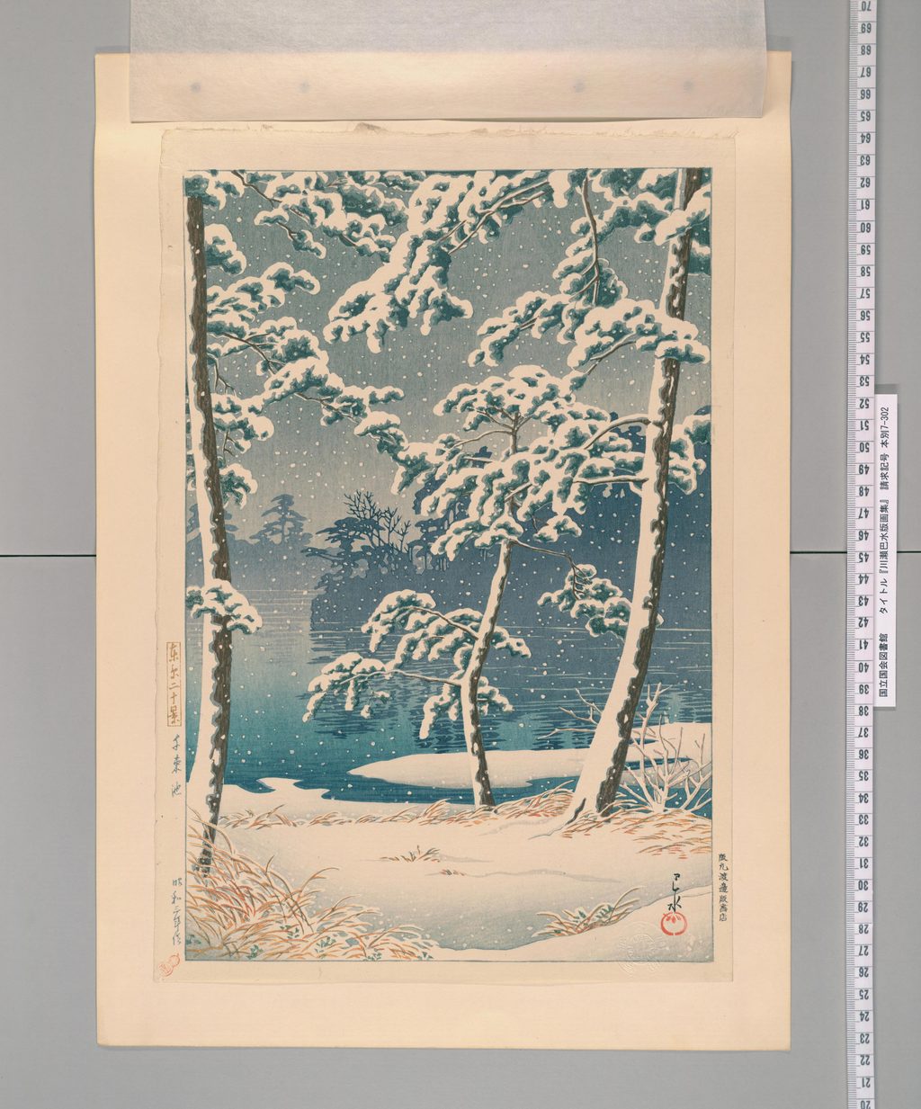
In the farmer's story Tanigawa Iwao wrote down in Musashino in 1919, Suribachiyama in Ōokayama and Mujinakubo in Senzoku were where Daidarabotchi planted his feet, and where he planted his staff became Senzoku Pond. When he took earth from one side with one hand and put it on the other, the place he took it from became the sea at Shinagawa and the place he put it became Mount Fuji. .

In the version in the History of Ōta Ward (1983), Daidarabotchi planted his staff around Senzoku, braced himself and urinated. The rise under his right foot became Suribachiyama, the hollow under his left foot Mujinakubo, the hole of his staff Koike Pond, and the pool of his urine Senzoku Pond. A clan of giants with long right arms lived at the Kugahara shell mound, and the mound is where they threw away the shells of the shellfish they gathered from the sea.

Photograph of a tall color woodblock print mounted on board, with a measuring scale at the right edge. Three snow-laden pines stand in the foreground on the bank of a pond in falling snow, their branches spreading wide. Beyond them the blue-green water stretches out, and the trees on the far bank blur in the snow. The near bank is covered in snow with brown dry grass showing through. A tall cartouche at the left edge reads "Twenty Views of Tokyo" with "Senzoku Pond" and "made in Shōwa 3" below, and Hasui's signature and red seal are at lower right.
Kawase Hasui, "Senzoku Pond" from Twenty Views of Tokyo (1928)
"Senzoku Pond" from Kawase Hasui's Twenty Views of Tokyo (1928). In the story Tanigawa Iwao recorded in 1919, the pond formed where Daidarabotchi planted his staff.
Kawase Hasui, Senzoku Pond (Twenty Views of Tokyo, 1928), National Diet Library Digital Collections

Senzoku Pond and Koike Pond lie in a valley floor cut by running water into the Ebara upland, a diluvial plateau a little over 30 meters above sea level, surrounded by bowl-shaped bluffs. .

Three steps across Musashino

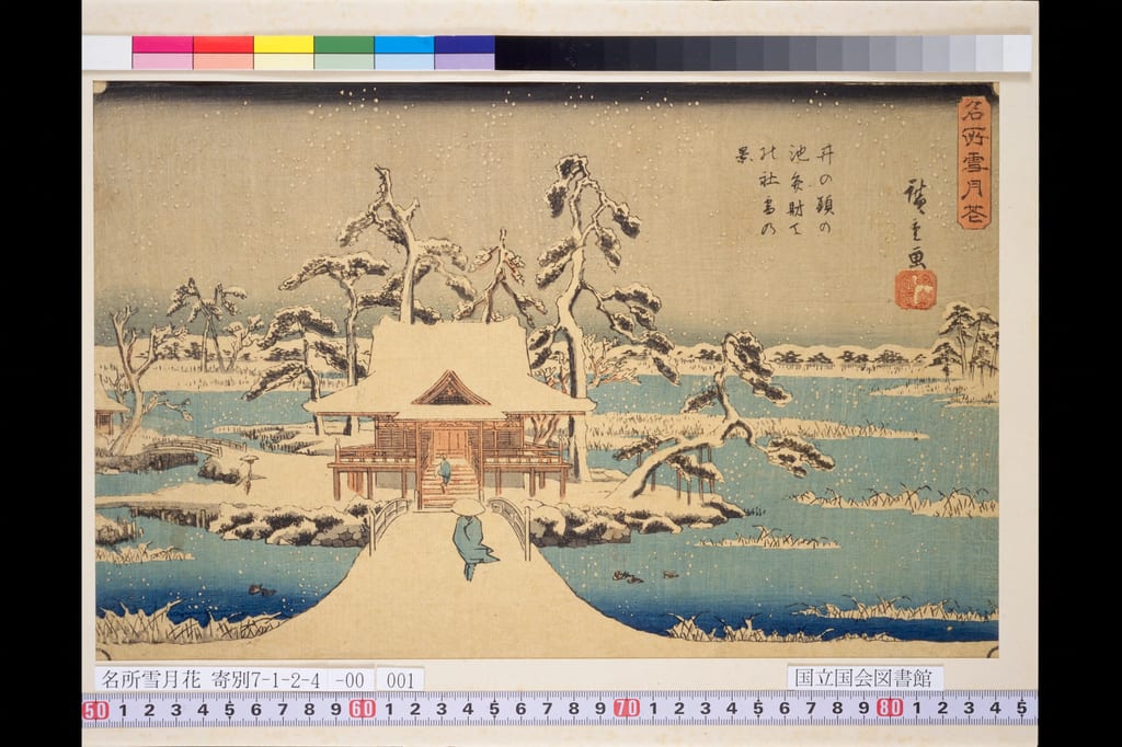
In the Musashino City legend, the ground sank wherever a very big person stepped as he crossed Musashino: at his first step, Zenpukuji, water welled up into a pond; his second, at Hatchō, became a hollow; and at his third, Inokashira, water welled up into a pond too. Earth that fell from his foot became the Hatchō Ōtsuka mound. The Hatchō hollow has been filled in, and only the Yokogawa Electric sports ground keeps its shape.

Photograph of a color woodblock print with a color chart along the top and a measuring scale and label along the bottom. In the middle of a pond in falling snow stands the Benzaiten shrine with its roof covered in snow, and a snowy path and small bridge lead to it from the foreground. A figure in a straw hat walks along the path toward the shrine, and another person stands in front of it. Snow-covered pines stand behind and beside the shrine, and dry reeds stick out of the snow along the blue water's edge. At upper right are the series title, the picture title and the signature "drawn by Hiroshige" with a red seal.
Utagawa Hiroshige, "Benzaiten Shrine at Inokashira Pond in Snow" from Famous Places: Snow, Moon and Flowers
"Benzaiten Shrine at Inokashira Pond in Snow" from Utagawa Hiroshige's series Famous Places: Snow, Moon and Flowers. In the Musashino City legend, water welled up in the giant's third footprint to make Inokashira Pond.
Hiroshige, Benzaiten Shrine at Inokashira Pond in Snow (Famous Places: Snow, Moon and Flowers), National Diet Library Digital Collections

The mountain whose vine broke

In the Sayama Hills he is called Deedarabotchi. Maruyama in Musashimurayama is a mountain Daitara-hōshi carried on his back with wisteria vines; the vine broke and he left it, so wisteria does not grow there, and the wells on the hill are his footprints. A sign at "The Well of Daitara-hōshi" in the hills of Akahori also says that his footprint, made as he walked carrying Maruyama with wisteria vines, became the well. .

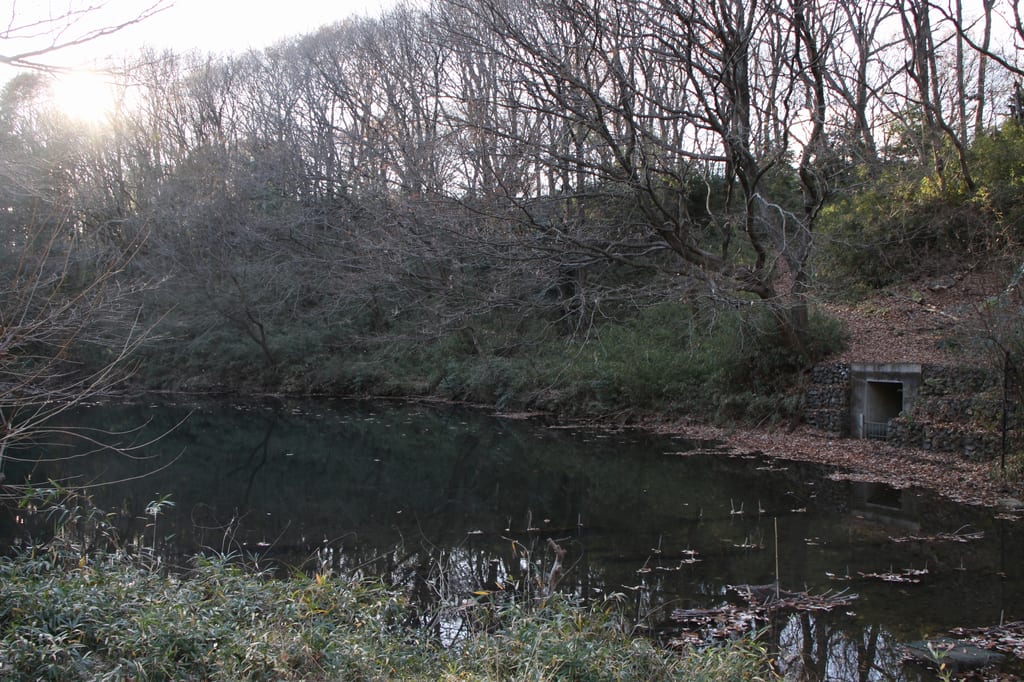
In Yui village near Hachiōji, the print of one foot he planted in a single stride when he tried to lift Mount Fuji onto his back is the hollow called Ike-no-kubo, and the other footprint is said to be in Suruga. The small hill at Nagire in Kawaguchi village is a mountain he dropped when his rope broke; unable to find wisteria vine, the giant grumbled, "From now on let no wisteria grow on this hill," and wisteria still does not grow there. .

Photograph of a pond surrounded by bare woods on a winter evening. Leafless trees and the sky are reflected in the dark water, where fallen leaves float. A low sun shines through the trees at upper left, and at the foot of the slope on the right is a small concrete sluice gate set in stonework. Dwarf bamboo grows in the foreground.
Nagaike Pond (Bessho, Hachiōji, Nagaike Park)
Nagaike Pond at Bessho, Hachiōji (photographed 2009). The same legend as Ike-no-kubo, the footprint of a giant bracing himself to carry Mount Fuji, is told of this pond.
多摩に暇人, Nagaike Pond in Nagaike Park, CC BY 3.0, via Wikimedia Commons

The Fujizuka mound in Fujimi-chō, Tachikawa, formed when the giant knocked out the earth packed between the teeth of his geta, and the Benten Pond is where rainwater collected in the hole he left as he walked.

Sagami plain and Ōmi

Matsunoya hikki records that the great marsh on Sagami plain is the footprint of Dairabotchi bracing himself to carry Mount Fuji on his back, and that there is no wisteria on the plain because he could not find any vine for a carrying rope. Kidan isshō tells that Daida-hōshi dug up the earth of Yoshizumi District in Ōmi into one basket load, walked three and a half steps east and tipped it out; the place he dug became the lake and the earth became Mount Fuji.

Giants of the fudoki

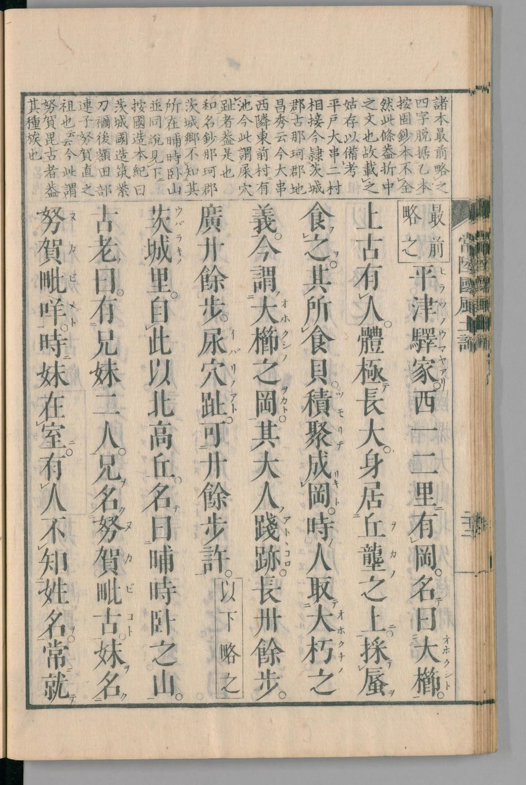
The Hitachi fudoki's entry on Ōkushi Hill in Naka District says that in high antiquity a person of enormous size sat on the hill and gathered clams to eat, and the shells piled up into a hill. The giant's footprint was more than forty paces long and more than twenty wide, and the hole of his urine about twenty paces across.

Photograph of a single page of an old printed book. Small annotations fill the upper register of the frame, and the main text below is in large kanji with reading marks and kana glosses, written vertically. Starting from the right with the words for "one or two ri west of the Hiratsu post station there is a hill called Ōkushi," it tells how a person of enormous size in high antiquity sat on the hill gathering shellfish to eat until the shells piled into a hill, and gives the length and width of his footprint and the size of the hole of his urine; toward the left begins the story of Kurefushi Hill.
Ōkushi Hill in the Hitachi fudoki (1839 edition)
The entry on Ōkushi Hill in Naka District in the Hitachi fudoki edited by Nishino Nobuaki (1839). It gives the giant's footprint as more than forty paces long and more than twenty wide, and the hole of his urine as about twenty paces across.
Hitachi fudoki, ed. Nishino Nobuaki (1839), National Diet Library Digital Collections

.

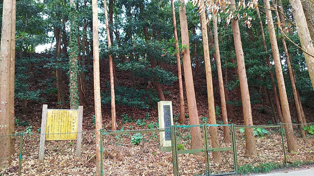
Photograph of the foot of a rising slope covered with cedars and broadleaf trees. On the leaf-strewn ground stand a yellow information board and a pale stone monument engraved "Ōgushi Shell Mound," with a green wire fence and small gate in front. Trees grow thickly up the slope.
The monument at the Ōgushi shell mound (Mito, Ibaraki)
The Ōgushi shell mound in Shiozaki-chō, Mito (photographed 2020), an Early Jōmon shell mound identified with Ōkushi Hill, which the Hitachi fudoki says was formed from the shells eaten by a giant.
七巫こ, Ōgushi Shell Mound, CC0, via Wikimedia Commons

In Taka District of the Harima fudoki, a giant who always walked stooping said that this land was high enough for him to walk upright, so it was named Taka, and his footprints became marshes here and there. Yanagita thought that stories of giants opening up the land were originally the shared heritage of this people and turned into children's tales after moving east. At the same time, he did not regard the giant stories of modern Hitachi as the fudoki's Ōkushi Hill story surviving unchanged for more than a thousand years.

Character Profile

This section is our own creative profile for storytelling. It is not historical fact or scholarship.

Rarity
Rare
Personality
Unable to find a wisteria vine to lift Mount Fuji, he stamps in frustration and declares, "From now on let no wisteria grow on this hill" (Hachiōji legend).
Compatibility
Few stories have him talking with people; his footprints and the mountains he carried are remembered through local place names.
Abilities
Each step sinks the ground, and his footprints become ponds and hollows (Musashino City, Daita)Carries mountains on his back with wisteria vines (Musashimurayama, Hachiōji)Knocks earth off his geta or straw sandals and makes mounds (Tachikawa, Toshima in Kita Ward)The hole of his staff and the pool of his urine become ponds (Senzoku Pond, Koike Pond)
Weaknesses
When his wisteria vine breaks, he drops the mountain he is carrying where he stands (Musashimurayama and Hachiōji legends).
Habitat
Kantō and Chūbu, centered on Tokyo. His footprints are said to remain at Daita, Senzoku Pond, from Zenpukuji Pond to Inokashira Pond, in the Sayama Hills, at Tachikawa, at Hachiōji and elsewhere.
Sources & References

9
  1. 長沢利明「東京のダイダラボッチ」(連載「民俗学の散歩道」21) — 長沢利明(西郊民俗談話会, 2014年12月) [民俗研究] Secondary都内のダイダラボッチ伝承地約三十か所を踏査した報告。柳田の語源説(大太郎法師)を紹介し、北区豊島の大道法師の塚(『十方庵遊歴雑記』)、代田橋(『紫の一本』、柳田の踏査記)、谷川磐雄(1919)の洗足池・摺鉢山・狢窪・品川の海・富士山の話、『大田区史』(1983)の小便型と久ヶ原貝塚の話、武蔵野市の善福寺池・八丁・井の頭池の三歩の話(武蔵野市 1982)、狭山丘陵の丸山と藤蔓・大多羅法師の井戸、立川の富士塚と弁天池(原田 1974)、八王子の池の窪・縄切・長池(清水 1985)を原文とともに引く。
  2. 柳田國男『一目小僧その他』所収「ダイダラ坊の足跡」 — 柳田國男(小山書店/国立国会図書館デジタルコレクション, 1934年) [民俗学原典]柳田國男「ダイダラ坊の足跡」。末尾に(昭和二年四月、中央公論)とある。「東京市は我日本の巨人傳說の、一箇の中心地と云ふことが出來る」と書き出し、『紫の一本』のダイタ橋の記事を引いて代田の長さ約百間の右片足の跡と湧き水の池、駒沢村の二つの足跡を訪ねた記録を載せる。『松屋筆記』の相模野の大沼と藤蔓、八王子由井村の池の窪と川口村の縄切の山、『奇談一笑』の近江の大々法師と富士山、『播磨国風土記』託賀郡の大人の地名説話を引き、常陸の巨人譚を古風土記の大櫛岡の物語がそのまま残ったものとは解さない、とする。
  3. 西野宣明校『常陸風土記』天保10年刊本 — 西野宣明校(和泉屋金右衛門/国立国会図書館デジタルコレクション, 1839年) [古典籍影印]西野宣明校『常陸風土記』天保10年(1839)刊。那賀郡の条「平津驛家西一二里有岡名曰大櫛。上古有人、體極長大、身居丘壟之上、採蜃食之。其所食貝積聚成岡。時人取大朽之義、今謂大櫛之岡。其大人踐跡長卌餘歩、廣廿餘歩、尿穴址可廿餘歩許」。
  4. 世田谷区『地名の由来(代田・羽根木・松原)』 — 世田谷区(世田谷区) [自治体資料] Reference代田の巨人足跡伝説による地名説と、1569年に「代田」の記録があることを併記する地域史解説。
  5. 國學院大學『大場磐雄博士資料の研究』 — 國學院大學(國學院大學) [大学研究資料] Reference谷川盤雄が1928年に大場姓へ改姓し、後に大場磐雄として活動したことを確認する大学研究資料。
  6. 大田区『池のみち周辺自然環境調査報告書』 — 大田区(大田区, 2018年(調査 2017年4月〜2018年3月)) [自治体調査] Reference大田区自然観察路「池のみち」と小池公園の自然環境調査。「洗足池、小池の地形は、荏原台と呼ばれる標高30メートル強の洪積台地が流水によって侵食された谷底である。したがって、周囲はスリバチ状の崖線に囲まれており」とある。
  7. 大田区『おおた区報WEB版(令和8年5月15日号)』 — 大田区(大田区, 2026年) [自治体資料] Reference洗足池の主な水源を武蔵野台地末端の湧水とし、旧称「千束郷の大池」を紹介する公的解説。
  8. 武蔵村山市『村山デエダラまつり概要』 — 武蔵村山市(武蔵村山市) [自治体資料] Reference大多羅法師が藤蔓で山を運び、足跡が井戸になった伝承と現代祭礼の継承を紹介する公的資料。
  9. 茨城県『大櫛の岡「大串貝塚」』 — 茨城県(茨城県) [自治体資料] Reference茨城県「常陸国風土記を訪ねる」の大櫛の岡(大串貝塚)。風土記の記載内容を書き下しで掲げ、所在地を水戸市塩崎町1064-1、国指定史跡とし、昭和初期の調査で縄文時代前期の遺跡と判明し、ヤマトシジミを主とした貝殻などが出土したとする。